Have you been wondering how far we have been cruising around the Whitsundays? You have been reading about the beautiful places we have been visiting but maybe you’re not sure where they are. Even if you’ve been following our track on the Chart page of the Débonnaire site, the distances might be hard to gauge. If so, the following will interest you.
I have created an outline of Port Phillip and Western Port and placed it over a map of the Whitsunday region. The outline is the same scale as the map so they are directly comparable. The map below shows that the central islands of the Whitsundays lie within the outline of Port Phillip, with Airlie Beach approximately aligned with Portarlington.
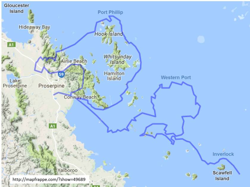
To the northwest, Gloucester Island is equivalent to about half way to Ballarat. To the southeast, Scawfell Island is about as far as Inverlock. Bait Reef to the northeast (it’s just outside the boundary of the map) corresponds to somewhere around Bundoora.
The comparison not only shows the extent of the Whitsunday region that we have sailed but also illustrates that many wonderful anchorages are within easy reach.
Question: Why is the port to the east of Port Phillip called Western Port?
I’ll post the answer in my next log entry.
